I feel that it is important to add burial
grounds, both active and inactive throughout the Town of North Collins and
the Cattaraugus Indian Reservation as well. I believe that a discussion of
the geographical evolution of the Town of Collins is in order. Understanding
this evolution can be a great asset to those researching their ancestors
they believe to have lived in the area.
Situated in the southwestern portion of
Erie County; the present Town of Collins is bounded by the Cattaraugus Creek
to the south; the Town of Concord to the east; the Town of North Collins to
the north; and a portion of the Cattaraugus Indian Reservation to the west.
Until 1772, although no township had been
designated, the area remained under the claims of Massachusetts, and was
known as Albany County. In 1772, the area became designated Tryon County.
This was changed to Montgomery County in 1784, with the Township of
Whitestown finally being designated in 1788.
During 1789 the area became known as
Ontario County and the township Northampton. A further division of territory
came the same year, creating Genesee County which remained intact until
1808. During the Genesee County reign two separate townships were
designated, first Batavia (1802), second Erie (1805).
In 1808 a further territorial division
occurred, creating Niagara County, thus the terminology "The Niagara
Frontier" which remains today. The Township of Willink was also
designated in 1808, in 1812, the area became the Town of Concord.
While the present Town of Collins
celebrates 1812 as it's original inception, it was not until March 16, 1821,
that the Town of Collins was actually set off from the Town of
Concord. Two weeks later, on April 2, 1821, the County of Erie was set
off from Niagara County.
The area remained known as the Town of
Collins, Erie County until November 24, 1852, when the final geographical division
was creating, setting aside the Town of North Collins and giving the area
the geographical territories known today.
Collins - Collins Center
Erie County
New York
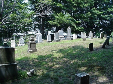
BURIAL GROUNDS
- INACTIVE
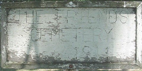
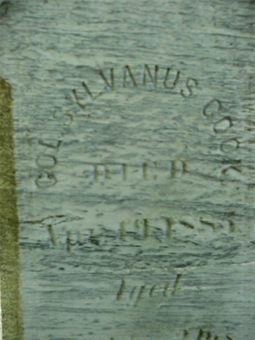
Clear Creek Friends Cemetery


As was the custom in the "Old World" early
Americans "lay their dead in a shadow of the church;" The Collins
- Collins Center area shows little exception to that rule. Relatively
speaking, if you locate a church, or the location of a past church, you will
also locate a burial ground.
The early Quaker meeting-house at Bagdad, also known as Clear-Creek
Friends, had its own burial ground as well. In the ALNORCA Series
the burial ground was said to have been located "on the abandoned
road which ran across the farm owned by Mr . Taylor Martin."
In reality the burial ground and Meeting House were located on a slope just a
bit northeast of the corner of South Quaker street and West Becker
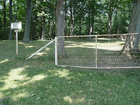
road. According to notes maintained by the Collins Friends, a log Meeting House was constructed at this site in 1819. A frame Meeting house was erected here in 1838, a few years later, another frame meeting house was constructed a northern section of Clear Creek near the present Route 39. The Clear Creek Meeting House was discontinued in 1850. It has been noted that more than 300 families are buried here, mainly
persons of the Society of Orthodox Friends, a group allowing no stones
to mark their resting places. The Collins Friends have invited me to utilize their records and resident cemetery expert in search of documentation concerning persons buried in this cemetery.
Any stones that may have been placed had disappeared long before the
1930's leaving any newer residents to believe that a mere empty field lay in
its place. The slope today is a field, plowed, planted and harvested by a
local farmer.
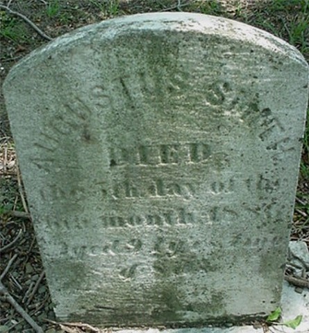
For posterity sake, we shall quote the ALNORCA Series to offer some
evidence of the people who were laid to rest in the Clear Creek Friends
Cemetery: "David Aikens was the first person to be buried there. He
was a blacksmith who had a shop in Taylor's Hollow as early as 1822. The
second was Mrs. Deborah Tucker. Members of the Soule family occupied a long
row of graves through the center of the yard. No trace of this cemetery
remains."
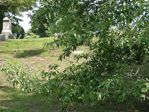
The
Harris Cemetery
Lying in the tangle of overgrowth and trees, on the back portion of the Ken Martin farm, lies the old Hicksite Friends cemetery (Hicksite
Friends were thusly noted because they were members of the
``liberal'' party, headed by Elias Hicks. Due to a change of views
concerning the divinity of Christ and the Atonement, this group seceded from
the conservative portion of the Society of Friends in the United States, continued next column